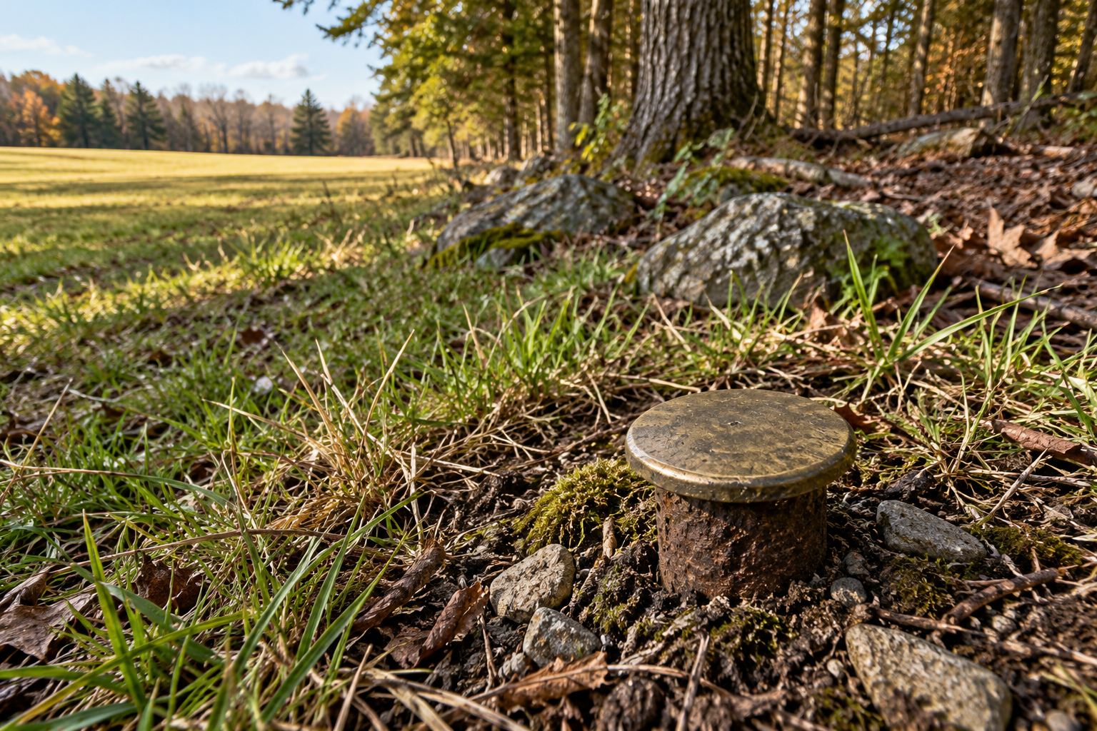
A capped rod in the grass looks reassuringly definite. It has a centre, a surface one can touch, perhaps a stamped number. Yet a surveyor trying to recover a land corner cannot treat every piece of metal as an answer. The rod might be the original mark, a later replacement, a nearby reference, or a control point set for another kind of survey. Its position has to be read with the records and the other marks around it.
That is why a boundary corner can outlast the object once placed at it. In the United States Public Land Survey System, or PLSS, generations of surveyors have left more than points in the ground. They have left descriptions of points, measurements to neighbouring corners, and nearby objects meant to testify to a corner's position. This account concerns that system and examples of state recording practice; boundaries made under other systems have their own histories and rules. The governing idea is still plain: a mark is most useful when another person can identify it, test it against the record, and recover the position if the mark disappears.
A corner has witnesses
The Bureau of Land Management's 2009 surveying manual lists the varied things that have marked public-land corners: a wooden post, a stone, an iron post with an inscribed cap, a tablet in rock, even a marked tree. The monument is the object set to identify the corner; its materials and markings help establish which survey placed it. The manual also names accessories: bearing trees, reference monuments, mounds, buried memorials and pits. These are aids to identifying the corner rather than a continuous line drawn across the land.
A bearing tree is particularly vivid evidence. The original surveyor could mark a nearby tree and record its direction and distance from the corner. If the post vanished, a later surveyor might still find the tree, a healed blaze, a stump or its remains. That remnant has value because a field note relates it to a particular corner. A tree without the record is merely a tree; a distance in a notebook without surviving context is a much weaker clue. The manual asks surveyors to search for the monument and its accessories together, while allowing for ordinary change: pits fill, stone mounds settle and blazes grow over.
The Minnesota Association of County Surveyors' 2021 remonumentation manual makes the sequence concrete. Research starts with original General Land Office notes and plats, then looks through later surveys, corner certificates, deeds, road records and other local sources. The field search uses that history to narrow the area. It can mean examining a decayed stump or carefully excavating where a buried mark may remain. The manual cautions that a map overlay or a calculated position can guide a search without replacing the visit to the ground.
That distinction matters when a modern receiver gives a position to many decimal places. A precise coordinate tells where a receiver was observed in a stated reference system. It does not, by itself, show whether the object under the receiver is the corner described by an old plat. The BLM's 2020 guidance for satellite measurements in cadastral surveys calls for repeated observations, checks, documentation and compliance with the 2009 manual and applicable state law. Measurement accuracy and identification of historical evidence are related tasks, but they answer different questions.
Nor is every official-looking disk a parcel corner. The National Geodetic Survey's description of its marks says disks, rods and other monuments can carry known position or elevation for mapping and construction as well as for surveying land. A geodetic mark may help a surveyor position a boundary survey. Its existence alone does not say that a property line passes through it. The purpose and record of a mark have to be established before its coordinates can be put to work.
What it means to lose the mark
The BLM manual distinguishes three conditions that ordinary speech often collapses. An existent corner has an original position identified by substantial evidence of the monument, accessories, records or reliable testimony. An obliterated corner has no surviving trace of the monument at the original spot, but other substantial evidence still recovers the position. A lost corner is the harder case: after the evidence has been exhausted, its original position cannot be determined and must be restored from other controlling corners under the applicable method.
Those categories turn on evidence, not on how much metal is visible. A missing post does not automatically make a corner lost. An iron pin in the vicinity does not automatically make it existent. The question is whether the found material, recorded ties and other credible evidence identify the original position. The manual explicitly allows reliable testimony and later survey records that tied to the original mark when it was present. It also warns against a quick decision: the search must consider original field-note calls, known corners and the natural changes that have affected the ground.
Only after that work does proportionate measurement enter the BLM's procedure for a truly lost PLSS corner. The surveyor retraces the original lines from accepted corners and examines the differences between old and new measurements. Remaining discrepancy is apportioned according to the original intervals; an identifiable original corner is not shifted simply because a newer measurement is neater. This is a rule for restoring a corner within that survey system, with safeguards for existing rights. It is not a general invitation to place a missing pin halfway between two convenient objects.
The record is part of the mark
The physical object needs a written counterpart that a later surveyor can find. Washington's survey-record statute, enacted in 1973, requires records to describe monuments found or placed, bearing trees and other accessories, bearings and line lengths, and ties to adjoining surveys. Its corner-record provisions call for the location of objects in relation to the corner and other information useful for relocating or identifying it. Those requirements turn a private field observation into an account that can be checked.
Washington's corner-restoration rule, last amended in 2018 and effective in 2019, gives a more specific example. When a formerly monumented federal-survey corner is physically reestablished and not recorded as part of a survey or plat, at least three references must be established and filed on a land-corner record. A valid Washington plane-coordinate set can count as one reference, but the rule recommends nearby references for accurate relocation. The precise number is Washington's rule, not a nationwide standard. Its logic is easy to see: a future surveyor should have several independent ways back to the point.
The Minnesota manual asks that a corner certificate include its history, the evidence accepted or rejected, details of the monument and its ties, and the method used to determine the position. A later worker can then follow the reasoning, not merely inherit a dot. If a fence has been treated as a line of occupation, or a local pin has been accepted as evidence, the record can say how it relates to the original survey. The fence or pin may matter; neither gains authority from appearance alone.
Marks are vulnerable. Roads are rebuilt, trees die, caps are buried, and small objects are moved. The durable part of a boundary survey is the relationship built around the corner: between the original record, surviving physical evidence, later measurements and a filed account of the judgment made on the ground. A good survey mark gives that relationship a visible place to begin. Its best service may come years later, when the visible part is gone and the trail back to it still holds.
A thought worth keeping?